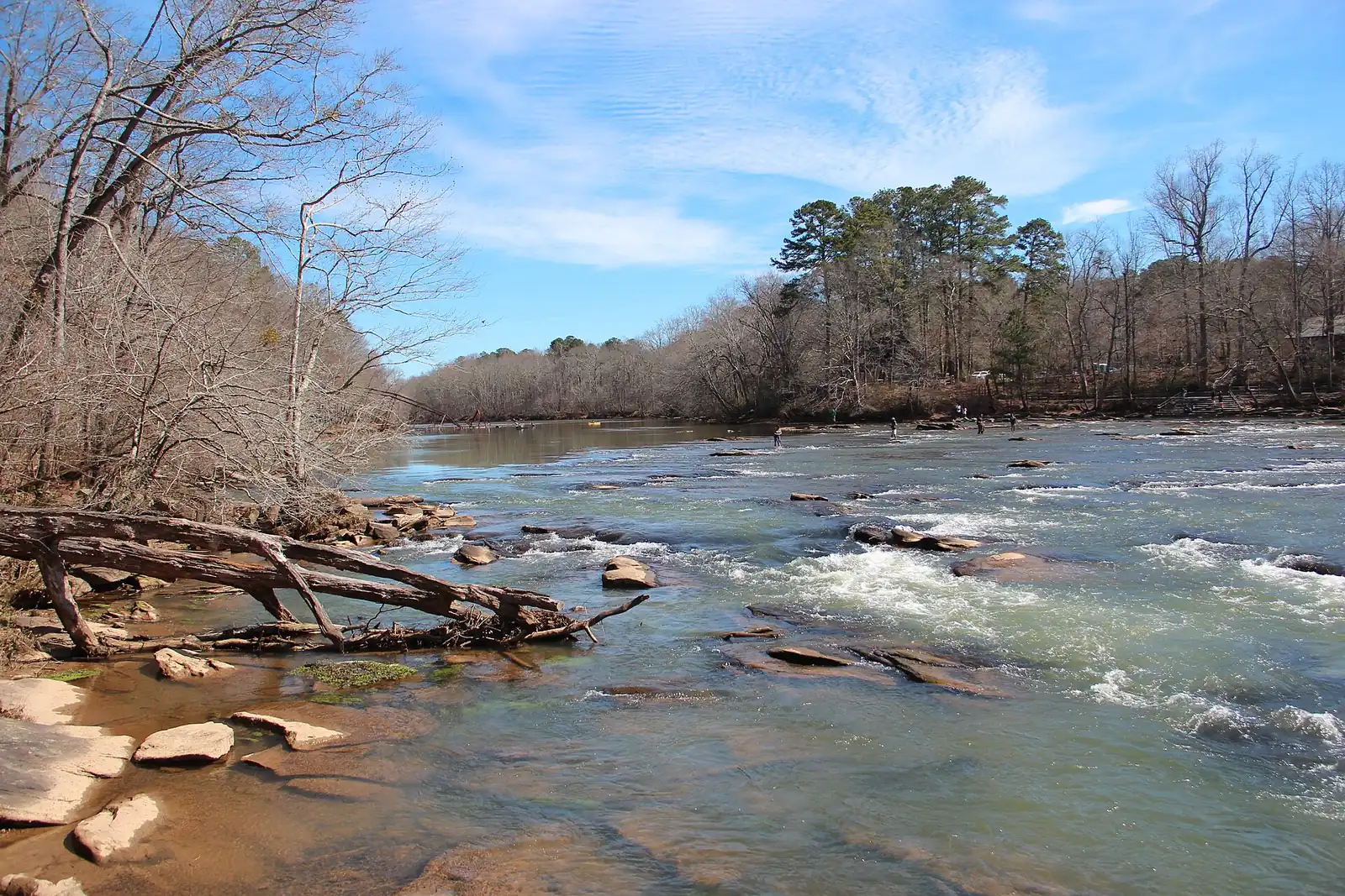
The Spalding Drive and Simpsonwood area of Peachtree Corners, by the river, is in ZIP 30092. Zillow's typical value there: $558,490 in August 2026.
Last checked Oct. 6, 2026. Sources: the City of Peachtree Corners’ 2045 Comprehensive Plan (PDF) and open data portal, Gwinnett County Public Schools zone map data, the state’s 2025 School Grades data, Zillow Research, Gwinnett County Parks and Recreation, Ride Gwinnett and OpenStreetMap.
The west side of Peachtree Corners’ river neighborhoods runs from Spalding Drive and Holcomb Bridge Road north to the Chattahoochee River. It is almost all single-family subdivisions, with a few condo and townhome communities near Spalding Drive, and it holds the city’s largest park, Gwinnett County’s 223-acre Simpsonwood Park.
What this means for you
- Zoned high school: Norcross High, for every address. Check yours with Find My School.
- Home value: $558,490 in ZIP 30092 in August 2026, according to the Zillow Home Value Index.
- Nearest interstate exit: I-85 exit 99, Jimmy Carter Boulevard, about 5.7 miles by road.
Part of our Peachtree Corners neighborhoods guide.
Where it is
The river forms the west and north edges. Holcomb Bridge Road and Spalding Drive form the south edge, and the line with our Jones Bridge area runs roughly along West Jones Bridge Road. The Central Business District is to the southeast. OpenStreetMap places Peachtree Station and North River Crossing here.
This is the western half of what the city’s 2045 Comprehensive Plan calls its Suburban Neighborhood: “the single-family neighborhoods located in the northern portion of the City.” The plan wants it to “continue to foster stable, established, owner-occupied housing” and says it separates the “environmentally-sensitive Chattahoochee River” from busier development.
The city’s 2026 address data has 3,141 addresses in this area, and every one is in ZIP code 30092.
Homes
The city’s parcel data counts 2,665 single-family houses and 176 townhomes here. Near Spalding Drive the city’s address data names the Wynfield Trace Apartments, the Peachtree Forest Plantation, Wedgewood Chase, Forest Hills at Peachtree Forest and Spalding Gate at Neely Farm condominiums, and the Peachtree Square townhomes.
The plan wants low-scale homes, “typical two-story single-family residential homes and one-story ranch-style homes,” and discourages apartments, townhouses, shops and industry. Schools and churches may locate only on primary streets.
Schools
How this area’s addresses split in Gwinnett County Public Schools’ zone map for 2026-27. Scores are 2025 College and Career Ready Performance Index (CCRPI) figures from the state’s School Grades report.
| Level | School | Share of addresses | 2025 CCRPI |
|---|---|---|---|
| High | Norcross High (report card) | 100% | 69.8 |
| Middle | Pinckneyville Middle (report card) | 100% | 79.9 |
| Elementary | Simpson Elementary (report card) | 77% | 90.8 |
| Elementary | Peachtree Elementary (report card) | 23% | 72.5 |
The state average was 78.0 and Gwinnett County Public Schools scored 81.5. Simpson Elementary is at 4525 E. Jones Bridge Road and Pinckneyville Middle at 5440 W. Jones Bridge Road. Paul Duke STEM High is a choice school open to the Norcross cluster. More in our Peachtree Corners schools guide.
Home values
The typical home value in ZIP 30092 was $558,490 in August 2026, down 2.2% from $571,159 in August 2025, according to the Zillow Home Value Index. The index is a modeled typical value for the middle third of homes, not a sale price. ZIP 30092 covers most of Peachtree Corners, apartments and condos included. The citywide figure was $542,915, down 2.3% on the year. More in our home prices guide.
Parks and trails
From Gwinnett County’s park pages and our parks and trails guide:
- Simpsonwood Park, 4511 Jones Bridge Circle: 223 acres with a 3.1-mile unpaved trail, a chapel and group camping.
- Jones Bridge unit of the Chattahoochee River National Recreation Area, on the river at the area’s north side, run by the National Park Service.
- Jones Bridge Park, 4901 E. Jones Bridge Road, on the north edge: 30 acres with river overlooks for fishing, a playground and soccer fields.
- Holcomb Bridge Park, 4300 Holcomb Bridge Road, at the southwest corner: 12 acres with fishing and a quarter-mile trail.
The plan expects more open space along the river over time, “through an expansion or reprogramming of Jones Bridge Park, a greenway along the Chattahoochee, or new open space.” Call 770-945-1466 for upstream water release times before you fish or paddle, as Gwinnett County advises.
Getting around
- Interstates: I-85 exit 99, Jimmy Carter Boulevard, about 5.7 miles by road; I-285 exit 31, Peachtree Industrial Boulevard, about 6.7 miles. Holcomb Bridge Road crosses the river into Fulton County toward Georgia 400.
- Town Green: about 2.6 miles by road.
- Airport: about 31.5 miles to Hartsfield-Jackson Atlanta International Airport. All are distances measured on the OpenStreetMap road network with the OSRM routing engine, not drive times.
- Bus: Ride Gwinnett Route 35 stops along Holcomb Bridge Road on the area’s south edge, according to Ride Gwinnett’s schedule data. It does not run Sundays.
More in our getting around guide.
Groceries and everyday stores
From OpenStreetMap, the nearest are outside the area:
- Publix, 7736 Spalding Drive, just outside the city line
- Trader Joe’s, 5185 Peachtree Parkway
How we drew this area
This area is the part of the city’s Suburban Neighborhood character area north of Holcomb Bridge Road and Spalding Drive and west of a line near West Jones Bridge Road, taken parcel by parcel from the city’s own character area map. School shares come from every address point inside it in the city’s 2026 address data, matched to the district’s zone maps on Oct. 6, 2026. Store and park locations are © OpenStreetMap contributors.
Frequently asked questions
Is the Spalding Drive area of Peachtree Corners a good place to live?
Here are the facts. It is mostly single-family subdivisions north of Spalding Drive, with 223-acre Simpsonwood Park and the Chattahoochee River. Every address is zoned for Norcross High, which scored 69.8 on the state’s 2025 CCRPI; most are zoned for Simpson Elementary, which scored 90.8. Zillow put the typical home value in ZIP 30092 at $558,490 in August 2026.
What elementary school serves Simpsonwood in Peachtree Corners?
Simpson Elementary for 77% of addresses in this area and Peachtree Elementary for 23%, in Gwinnett County Public Schools’ 2026-27 zone map.
Where is Simpsonwood Park?
At 4511 Jones Bridge Circle in Peachtree Corners. Gwinnett County lists it at 223 acres with a 3.1-mile unpaved trail, a chapel and group camping.
What ZIP code is Spalding Drive in Peachtree Corners?
- Every address in this area in the city’s 2026 address data is in ZIP code 30092.
Have your say