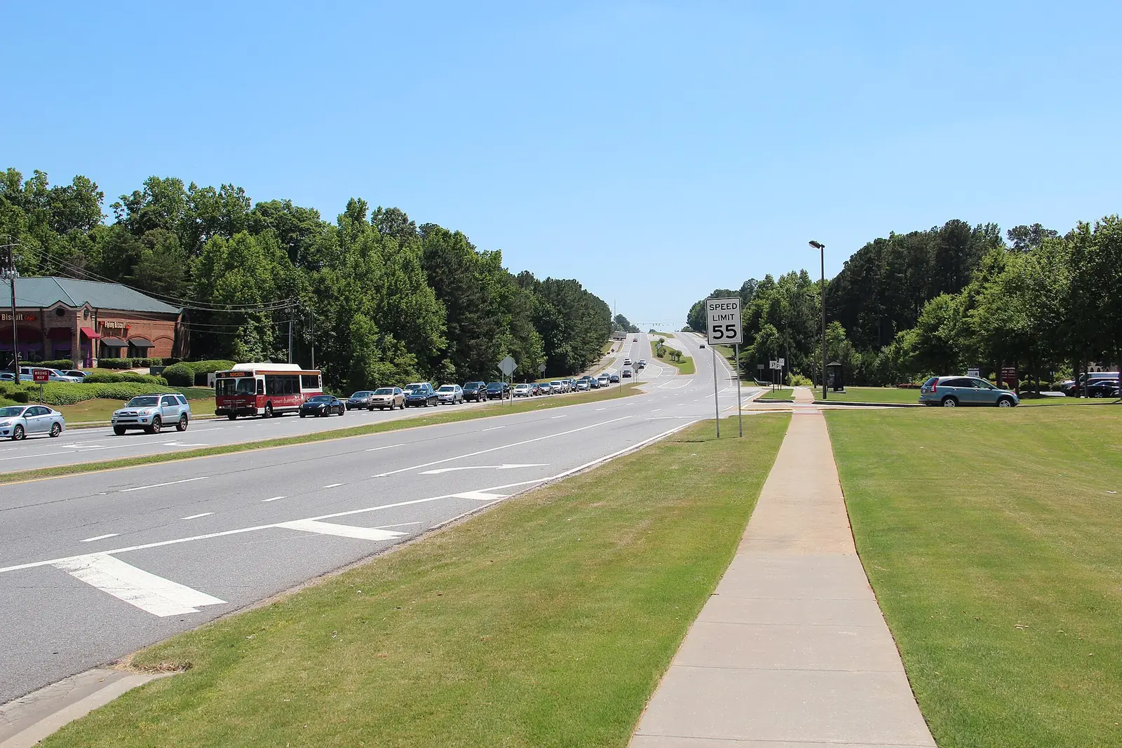
Peachtree Corners' nine main areas, from Jones Bridge to Mechanicsville: ZIP codes, zoned schools and August 2026 Zillow home values, with a map.
Last checked Oct. 6, 2026. Sources: the City of Peachtree Corners’ 2045 Comprehensive Plan (PDF) and its open data portal, Gwinnett County Public Schools’ zone map data and Find My School tool, the state’s 2025 School Grades data, Zillow Research, the Census Bureau and OpenStreetMap.
Peachtree Corners is a city of 42,373 people in the southwest corner of Gwinnett County, according to the Census Bureau’s 2020-2024 American Community Survey five-year estimates. It began operating as a city on July 1, 2012, and covers about 17 square miles, with seven miles of the Chattahoochee River on its western edge, according to the city. Peachtree Parkway, Georgia 141, runs through the middle from the river to the south end, and Peachtree Industrial Boulevard crosses the south side. There is no interstate inside the city: I-85 is to the south and I-285 to the southwest.
Three things to know before you look at a listing:
- The north is houses; the south is offices, apartments and industry. The city’s 2045 Comprehensive Plan calls its Suburban Neighborhood character area, the single-family neighborhoods “in the northern portion of the City,” and puts Technology Park, the Holcomb Bridge corridor and the Buford Highway industrial strip to the south.
- One main ZIP code. In the city’s 2026 address data, 83% of addresses are in 30092. The rest are in 30360 (southwest), 30096 and 30097 (east of Peachtree Parkway) and 30071 (south). Many homes have a Norcross mailing address.
- School zones do not follow city limits. Gwinnett County Public Schools splits the city between its Norcross and Duluth clusters. In the district’s 2026-27 zone map, 89% of city addresses are zoned for Norcross High and 11%, all east of Peachtree Parkway, for Duluth High. Five elementary schools serve all but a few dozen addresses. Always check one address with Find My School.
The areas at a glance
Shares are of each area’s addresses in the city’s 2026 address data, matched to the district’s zone map on Oct. 6. Home values are the Zillow Home Value Index for August 2026: a modeled typical value for the middle third of homes in the whole ZIP code, not a sale price. The citywide figure was $542,915.
| Area | Main ZIP code | Zoned high school | Typical value, main ZIP |
|---|---|---|---|
| Town Center and Technology Park | 30092 | Norcross | $558,490 |
| Holcomb Bridge | 30092 | Norcross | $558,490 |
| Peachtree Corners Circle | 30092 | Norcross | $558,490 |
| Southern Gateway | 30092 | Norcross | $558,490 |
| Mechanicsville | 30071 and 30360 | Norcross | $357,048 (30071) |
| Medlock Bridge | 30092 and 30096 | Duluth (65%), Norcross (35%) | $558,490 (30092) |
| Spalding Drive and Simpsonwood | 30092 | Norcross | $558,490 |
| Jones Bridge | 30092 | Norcross | $558,490 |
| Lockridge Forest | 30360 | Norcross | $503,274 |
Map of the areas
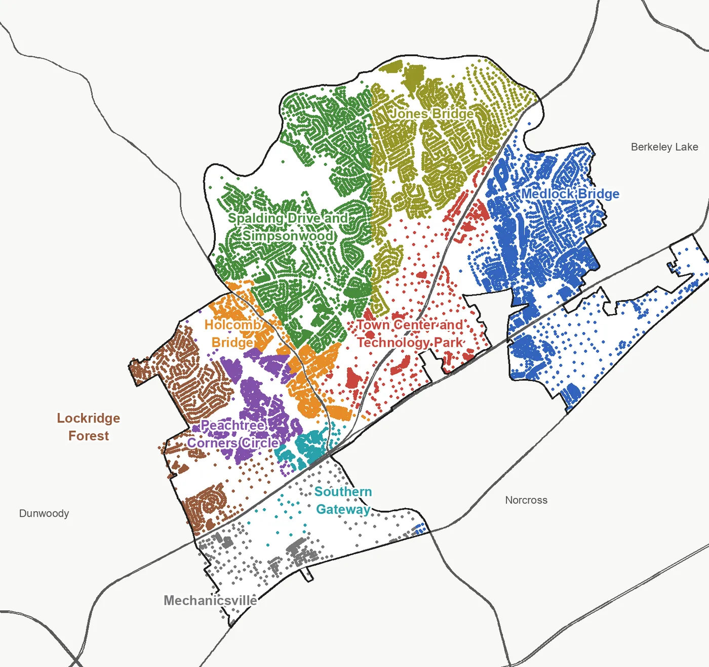
Map by Peachtree Corners Daily. Each dot is an address in the City of Peachtree Corners’ 2026 address data, colored by area. Areas follow the character areas in the city’s 2045 Comprehensive Plan and the main roads it names; city limits are from the Census Bureau and roads from OpenStreetMap, © OpenStreetMap contributors. Area edges are approximate.
The middle of the city
Town Center and Technology Park. The plan’s Central Business District: Town Center and the Town Green, The Forum, City Hall and the office parks of Technology Park, with townhomes and new apartments. All zoned for Norcross High.
Holcomb Bridge. Holcomb Bridge Road, Georgia 140, from the river to Peachtree Industrial Boulevard: apartments, condos, quadraplexes and strip centers the city wants to redevelop.
Peachtree Corners Circle. The plan’s Transitional Growth area and the city’s densest: 4,145 addresses, most of them apartments and condos.
The south side
Southern Gateway. Apartments along Jimmy Carter Boulevard north of Peachtree Industrial Boulevard and the Governors Lake office area, the city’s entrance from the south. Zoned for Stripling Elementary.
Mechanicsville. The historic neighborhood on Buford Highway, with the 1911 Mechanicsville School House, among warehouses and the rail line.
East of Peachtree Parkway
Medlock Bridge. Neighborhoods along Medlock Bridge Road, townhomes and apartments near Town Center, and an office and warehouse strip south of Peachtree Industrial Boulevard by Pinckneyville Park. The only part of the city zoned for Duluth High.
The river neighborhoods
Spalding Drive and Simpsonwood. Subdivisions north of Spalding Drive and Holcomb Bridge Road, with 223-acre Simpsonwood Park and the Jones Bridge unit of the Chattahoochee River National Recreation Area.
Jones Bridge. Subdivisions along East and West Jones Bridge roads, with Simpson Elementary, Pinckneyville Middle and Jones Bridge Park. Almost all zoned for Simpson Elementary.
Lockridge Forest. The southwest corner between Spalding Drive, Winters Chapel Road and Peachtree Industrial Boulevard, on the Dunwoody line. Mostly ZIP 30360.
Comparing Peachtree Corners with its neighbors
Taxes, schools, home values and commutes for Peachtree Corners and its three nearest city neighbors, side by side: Peachtree Corners vs. Norcross vs. Doraville vs. Johns Creek. For the citywide market, see our home prices guide; for every school, our schools guide. Taxes: our property tax guide. Getting set up: moving here.
How we built this
We named only areas a public source places on a map. The sources were:
- The city’s plan. The 2045 Comprehensive Plan, dated August 2023, and its character area map (PDF) divide the city into nine character areas: Central Business District, Holcomb Bridge Corridor, Employment Corridor, Industrial Corridor, Transitional Growth, Town Center Corridor, Suburban Neighborhood, Village Residential and Southern Gateway. Five of our areas follow one character area each. We joined the Mechanicsville Village Residential area with the industrial and employment strip around it on Buford Highway, and the Town Center Corridor with the neighborhoods east of Peachtree Parkway.
- Main roads. The plan does not divide the Suburban Neighborhood, so we split it along Peachtree Parkway, Holcomb Bridge Road and, in the north, roughly along West Jones Bridge Road, and named each part for its main road, park or an OpenStreetMap place name.
- The city’s GIS data. The city’s open data portal publishes the character area map parcel by parcel and 21,010 address points, which is where the address counts, ZIP shares and apartment and condo names on each page come from.
- School zones from Gwinnett County Public Schools’ elementary, middle and high school zone map layers, updated in August 2026, matched to every address point.
- Place names from OpenStreetMap, © OpenStreetMap contributors.
We found no homeowners association list published by the city, so these pages do not list HOAs. Area edges are approximate; Find My School and the Gwinnett County Tax Commissioner’s records are the authority for any one address.
Frequently asked questions
What are the neighborhoods in Peachtree Corners?
Our guide covers nine areas: Town Center and Technology Park, Holcomb Bridge, Peachtree Corners Circle, the Southern Gateway, Mechanicsville, Medlock Bridge, Spalding Drive and Simpsonwood, Jones Bridge and Lockridge Forest. They follow the character areas in the city’s 2045 Comprehensive Plan and the main roads it names.
What ZIP codes are in Peachtree Corners?
Mostly 30092. In the city’s 2026 address data, 83% of Peachtree Corners addresses are in 30092, 6% in 30360, 5% in 30096, 4% in 30071 and 2% in 30097.
What high school is Peachtree Corners zoned for?
Mostly Norcross High. In Gwinnett County Public Schools’ 2026-27 zone map, 89% of city addresses are zoned for Norcross High and 11%, all east of Peachtree Parkway, for Duluth High. Paul Duke STEM High is a choice school open to the Norcross cluster.
Does Peachtree Corners have a city property tax?
No. The city levies zero mills; homeowners pay Gwinnett County, school and county district levies, 34.5 mills in total for 2026, according to the Gwinnett County Tax Commissioner.
Is Peachtree Corners on Georgia 400?
No. The city sits between I-85 and I-285. The nearest exits are I-85 exit 99, Jimmy Carter Boulevard, and I-285 exit 31, Peachtree Industrial Boulevard; Georgia 400 is across the Chattahoochee River to the west.
Have your say